 |
So Many Places To Visit!
|
------- |

Ecuador |
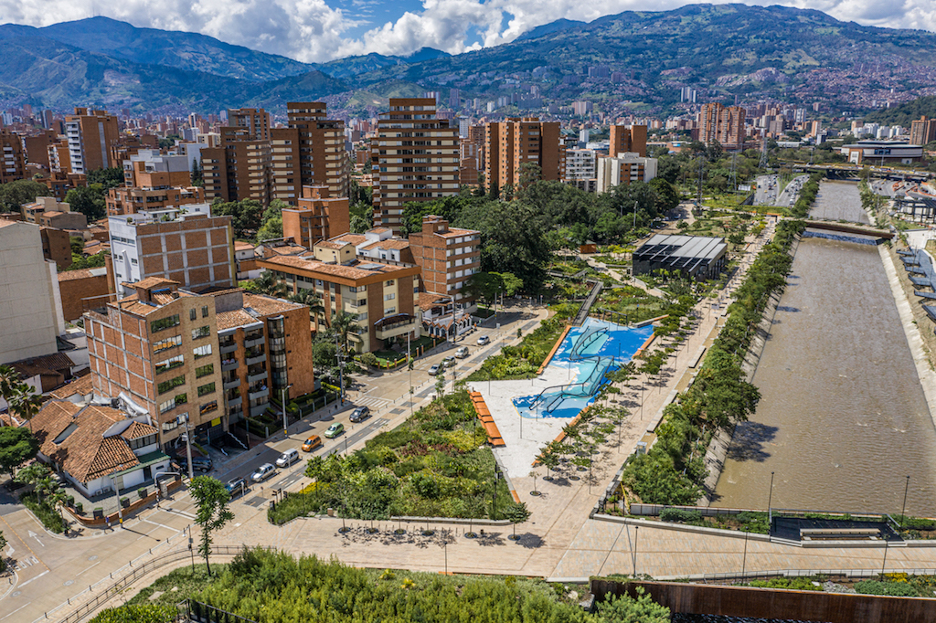
ECUADOR -- NATURAL AREA -----------------184[ARTICLE] | |||
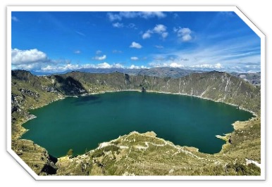
Lagoon Quilotoa, EcuadorBy Estefanía Muriel for Ruta Pantera on 8/12/2025 10:16:34 AM |
||||
| Quilotoa is a volcano and water-filled caldera—a crater lake—located in Cotopaxi Province, in the Ecuadorian Andes, at an altitude of approximately 3,914 meters above sea level. This caldera, approximately 3 km in diameter, formed after a volcanic collapse due to a catastrophic VEI-6 eruption approximately 800 years ago, an event that generated pyroclastic flows and lahars that reached the Pacific Ocean, spreading ash throughout the northern Andes. Since then, the crater has accumulated a lake approximately 250 meters deep with emerald-green hues, the result of dissolved minerals and changing light conditions. Fumaroles at the bottom of the lake and hot springs on the eastern flank attest to its still-active geological dynamics. | ||||

|
What makes Quilotoa unique The name Quilotoa comes from the Quechua words "quiru" (tooth) and "toa" (princess), which together mean "princess's tooth." Although admission used to be fee-based, it has been free since January 12, 2017, thanks to agreements between the Ministry of Tourism and other entities. The lake's color changes depending on sunlight and cloud cover, allowing for different shades of emerald green to be seen during different visits. Highlights you can't miss Visiting Quilotoa invites you to descend to the lake and enjoy the scenery from the bottom of the crater. The descent takes between 30 minutes and an hour, and the ascent can take one to two hours, depending on your physical pace; those who prefer a break can hire mules for about $10 USD. At the lagoon, you can rent a kayak for approximately $3 USD per half hour, or even take a boat for similar prices. Hiking along the caldera rim is also popular, a four- to seven-hour hike that offers breathtaking views. As for gastronomy, hostels often offer typical Andean dishes such as soups, potatoes, chochos (chochos), mellocos (mellocosas), fava beans, or even guinea pig. The cost of a full-day tour from Quito, including transportation, a guide, and lunch, can be around $25 USD; breakfast on these tours costs around $5 USD. Regarding festivities, there isn't a festival unique to Quilotoa, but nearby, in Pujilí, there's an indigenous market and the colorful Corpus Christi celebration, as well as a market held on Thursdays in Saquisilí, featuring folkloric dances and traditional costumes. Options to continue discovering | |||

|
Near Quilotoa, along the famous Quilotoa Loop, you can visit Malqui Machay, an archaeological site associated with the last Inca emperor Atahualpa, located about 30 km from Chugchilán. You can also see cloud forests next to the Los Illinizas Ecological Reserve, which encompasses protected páramos and montane forests located in the foothills of the volcano with rich biodiversity. In Zumbahua, just 14 km from the crater, there is a vibrant Saturday artisan market, with temperatures between 8°C and 18°C. In Sigchos, you can explore nature trails or explore the ecological landscape. Prices in these areas vary: admission to Malqui Machay or local markets is often nominal or free; only comprehensive tours include transportation. These sites complement a visit to Quilotoa very well, diversifying the cultural and natural experience. The best way to access the place From Quito to Quilotoa, the distance is approximately 178–180 km, which takes approximately 3 to 3.5 hours by private vehicle or tour, and 4 to 4.5 hours using public transportation with a transfer in Latacunga. From Quito, you can take a bus from the Quitumbe bus station to Latacunga (USD 1–3 USD, approximately 1–1.5 hours). Then, take a bus from Latacunga to Zumbahua for USD 2, and from there, take local transportation to the caldera. From Zumbahua, a taxi costs between USD 10 and USD 15. The area offers basic accommodations very close to the crater, such as Runa Wasi, Hostal Chukirawa, or Hostería Alpaka; prices start at around $10 USD per night, depending on the season. There are no ATMs in the area, so it's essential to carry cash. The best times to visit are from May to September, when there's more sun and less chance of clouds; from October to April, the weather is cloudier and rainier. The climate is cold, especially at altitude, so it's recommended to pack layers of warm clothing, sunscreen, and water, and leave early to take advantage of the clear views. Practical and safety tips Quilotoa is a very safe and peaceful destination, with a friendly indigenous community, all concentrated in a small walkable area. Even so, it's wise to travel during the day and be alert to the weather and slippery or exposed terrain, especially when descending or walking along the caldera rim. Carrying enough water, a basic first-aid kit, and communication skills are essential; if you're doing the Quilotoa Loop or longer hikes, it's advisable to share your plan and use marked trails. Regarding interaction with rural dogs, most are friendly; if one seems aggressive, remaining calm is sufficient. Finally, due to the altitude, it's important to stay well hydrated and acclimatized—as an 82- and 73-year-old couple did when they successfully completed the Quilotoa Loop after a few days in Quito—an inspiring example that with pause and preparation, it's possible to fully enjoy the place. | |||
| --rutapanter.com-- |
| Instagram: | Email contact: | Interest area: |

The San Juan Islands, United States
Located in the far northwest of Washington state, near the Canadian border and between the mainland and Vancouver Island, the San Juan Islands are an archipelago of mor [read more.]
Whistler, Alabama, United States
Whistler is a small community located in Mobile County, Alabama, in the southeastern United States. It is not a traditional tourist town or a mass tourism destination, [read more.]
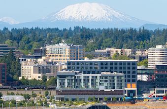
Vancouver, United States
Vancouver is a city located in Washington state, just north of the Columbia River and across the river from Portland, Oregon. Although many people confuse it with the f [read more.]
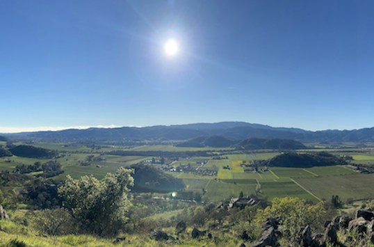
Napa Valley, California. United States
Napa Valley is one of the world's most prestigious wine regions, located in Northern California, approximately 80 kilometers from San Francisco. Its modern history be [read more.]
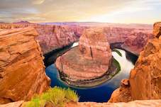
Grand Canyon, United States
The Grand Canyon is one of the most iconic natural landmarks in the world, located in northern Arizona and carved over millions of years by the Colorado River. Stretchi [read more.]
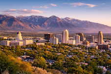
Salt Lake City, United States
Salt Lake City is the capital of the state of Utah and the cultural and economic center of the region known as the Wasatch Front. Founded in 1847 by Mormon pioneers led [read more.]
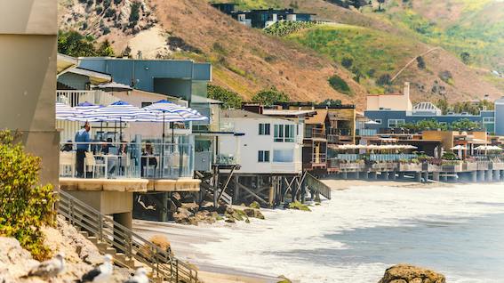
Malibu, United States
Malibu is a coastal city located in the state of California, about 30 miles west of downtown Los Angeles. Known for its scenic beaches, Pacific Ocean cliffs, and celebr [read more.]
To see more Waypoints in North America, please become a member here.
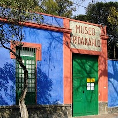
The Frida Kahlo Museum
The Frida Kahlo Museum, known worldwide as the Blue House, is located in the heart of Coyoacán, one of Mexico City’s oldest and most culturally rich neighborhoods. B [read more.]
Dominica, Caribbean
Dominica is an island country located in the Lesser Antilles of the Caribbean, situated between the French islands of Guadeloupe (to the north) and Martinique (to the south). Its capital and [read more.]
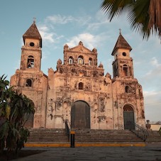
Granada, Nicaragua
Granada, also known as the "Great Sultana," is one of Nicaragua's most prominent colonial cities, renowned for its abundance of churches and religious facades. Founded in the 16th century, [read more.]
Isla Mujeres, México
Off the coast of Cancún, just 19.7 kilometers across the Caribbean Sea, lies Isla Mujeres, “a small paradise where Mayan history, island tranquility, and sustainable tourism converge” ( [read more.]
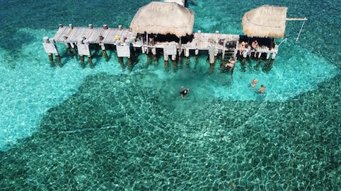
Holbox Island, Mexico
Holbox Island, whose name means "black hole" in Mayan and is pronounced "hol-bosh," is a peaceful island located in the Yucatán Channel, north of the peninsula, in the state of Quintana Roo [read more.]
Barra del Colorado, Costa Rica
Barra del Colorado is a remote enclave located on the northeastern tip of Costa Rica's Caribbean coast, in the province of Limón, bordering Nicaragua. It has been protected as a National [read more.]
Zihuatanejo, Mexico
Zihuatanejo is a former fishing village located in the bay of the same name, surrounded by the Sierra Madre del Sur mountains. It developed alongside Ixtapa since the 1970s, but retaining it [read more.]
To see more Waypoints in Central America, please become a member here.
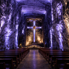
The Salt Cathedral of Zipaquirá, Colombia
The Salt Cathedral of Zipaquirá is an underground temple carved into a former salt mine, located in the Salt Park on the outskirts of Zipaquirá (Cundinamarca). Its modern architecture comb [read more.]
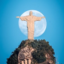
Christ the Redeemer, Rio de Janeiro
Christ the Redeemer stands atop Corcovado Mountain, within Tijuca National Park, dominating the Rio de Janeiro skyline with an imposing and serene presence. This monumental statue, 30 meters [read more.]
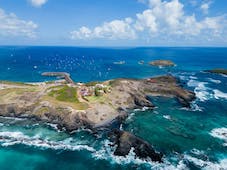
Fernando de Noronha, Brazil
Fernando de Noronha is a small volcanic archipelago in the South Atlantic. It is famous for its golden sand beaches, crystal-clear waters, and abundant marine life; much of the territory (ap [read more.]
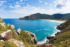
Florianópolis, Brazil
Florianópolis, affectionately known as Floripa, is the capital of the state of Santa Catarina, located partly on Santa Catarina Island and partly on the mainland in southern Bra
[read more.]
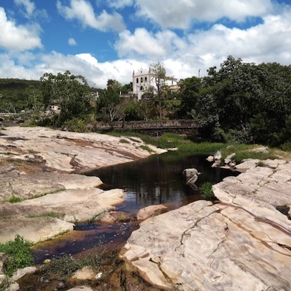
Chapada Diamantina, Brazil
Chapada Diamantina National Park, created in 1985 and managed by ICMBio, protects over 152,000 hectares of the Serra do Sincorá mountain range in the state of Bahia. Its territory encompass [read more.]
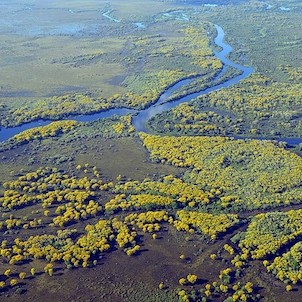
The Great Pantanal, Brazil
The Gran Pantanal is the world’s largest expanse of tropical wetlands, a vast territory of floodplains that extends primarily across the Brazilian states of Mato Grosso do Sul and Mato Gro [read more.]
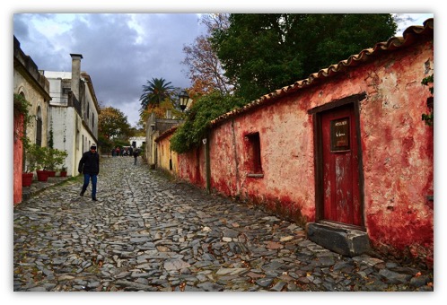
Sacramento Colony, Uruguay.
Colonia del Sacramento, on Uruguay's western coast opposite Buenos Aires, is a magnet for those seeking photogenic charm, cobblestone streets, and a leisurely pace. Founded by the Portugue [read more.]
To see more Waypoints in South America, please become a member here.
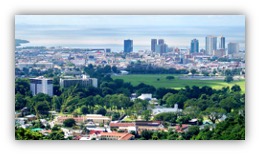
Port of Spain, Trinidad and Tobago
Puerto Rico
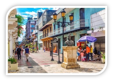
The Colonial Capital of Santo Domingo
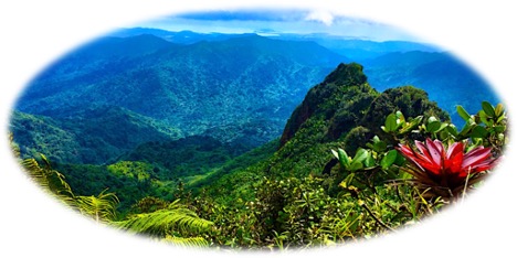
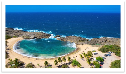
El Yunque, Puerto Rico
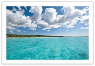
Eagles Bay, Dominican Republic
To see more Waypoints in The Caribbean, please become a member here.

|
Waypoint Finder (Over 1,000 destinations in PanAmerica) |
|---|