 |
So Many Places To Visit!
|
------- |

Puerto Rico |
PUERTO RICO -- NATURAL AREA -----------------53[ARTICLE] | |||
El Yunque, Puerto Rico
By Estefanía Muriel for Ruta Pantera on 7/25/2025 8:01:06 PM |
||||
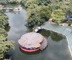
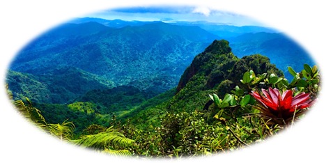
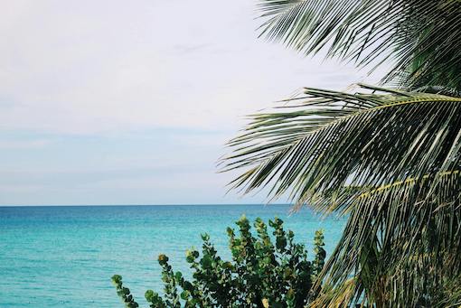
| El Yunque, officially El Yunque National Forest, is the only tropical rainforest in the United States National Forest System, open to the public in Puerto Rico. It occupies about 29,000 acres (≈ 113 km²) in the Luquillo Mountains, northeast of the island, encompassing municipalities such as Río Grande, Luquillo and Fajardo ( US Forest Service ). Its name comes from the Taíno “Yu-Ke”, meaning “White Land”. Originally declared a forest reserve by King Alfonso XII in 1876, it was designated a National Forest in 1903 by President Theodore Roosevelt . Throughout the 20th century, especially with the rise of the Civilian Conservation Corps (CCC), infrastructure, trails and viewpoints were built that today are part of its historical wealth ( US Forest Service ). | ||||

|
What makes Yunque unique It is estimated that almost 40% of the forest's flora is endemic to Puerto Rico, with more than 500 tree species spread across four vegetation zones based on altitude ( Facebook ). Each year it receives an average of 120 to 240 inches of rain, making it one of the rainiest forests in the world. It is also home to iconic species such as the coquí frog, the recovering Puerto Rican parrot, and Taino pandas depicted in petroglyphs scattered throughout the area ( Discover Puerto Rico ). | |||

|
Highlights you can't miss To begin your visit, it's recommended to stop at the El Portal Visitor Center, located at kilometer 4.3 of PR-191. Featuring sustainable architecture, it offers interactive exhibits, a short audiovisual presentation, and a small cafe ( Discover Puerto Rico ). Popular trails include La Coca, La Mina (with waterfalls and swimming holes), and El Angelito, which culminates in a natural lagoon after a ≈4 km hike ( Discover Puerto Rico ). Two viewpoints stand out: Yokahú Tower (21 m high, built in 1963), with views of the Atlantic Ocean, and Mt. Britton Tower, nestled in the mist. After the hike, it's worth checking out the nearby restaurants. In Río Grande, Rico Pan Bakery offers Creole sandwiches with coffee for $6–$8 USD; Degree 18 Juice Bar offers smoothies and natural bowls for $8–$12 USD; and Carabali Bar & Grill, in Luquillo's Carabalí Rainforest Adventure Park, offers meat and seafood dishes for $20–$30 USD ( PlateaPR ). The family-friendly atmosphere of Don Pepe (Río Grande) combines traditional cuisine with live music, offering dishes for $15–$25 USD ( PlateaPR ). If you happen to be celebrating a patron saint's day in the surrounding towns, you can enjoy masks, dancing, and chinchorreo-style kiosks, especially in Luquillo. Options to continue discovering Less than 15 km away are the famous “Luquillo kiosks,” a row of beachside restaurants serving pinchos, seafood, and fried foods for $5–15 USD ( PlateaPR ). In the same forest, the historic Baño Grande is a former swimming pool built by the CCC (1935–1968) and now a public heritage site. In Río Grande and Fajardo, there are museums such as the Taíno Indian Museum ($2–5 USD) and parks such as Fajardo National Park. A little further away, the Guajataca State Forest, with caves and trails, offers camping for $4 USD per night ( Wikipedia ). The best way to access the place From San Juan, the fastest route is to take PR-66 (toll road) and then PR-3 to Palmer, a journey of approximately 40 km (25 mi) in one hour; from there, PR-191 ascends to the park. Heavy traffic is common on weekends, so the federal government invested $1 million in a park-and-ride system to ease congestion of up to 3,000 cars per day ( AP News ). Lodging options include rural inns in Río Grande or Luquillo, for $100–150 USD per night, and forest campsites (when available) for about $20–30 USD per night. A full visit can last from six hours with several hikes and a food break, to a weekend to relax and explore the area. The climate is tropical and rainy, with temperatures consistently around 21°C (70°F) year-round, with no distinct seasons. The driest season is from February to April, ideal for visits due to the lower humidity and less rain. Practical and safety tips The best suggestion is to reserve your spot in the National Forest in advance, visit the official website for trail status, and start early to avoid crowds and traffic. Wear non-slip shoes and a poncho; the terrain tends to get wet quickly. Do not swim in unauthorized areas. El Yunque is safe, but it's essential to keep the area clean (take your trash with you) and respect the signs. In case of emergencies, use PR-191 and PR-3 trails, and bring extra water and snacks. | |||
| --rutapanter.com-- |
Listen to this article. |
| Instagram: | Email contact: | Interest area: |

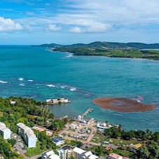
The San Juan Islands, United States
Located in the far northwest of Washington state, near the Canadian border and between the mainland and Vancouver Island, the San Juan Islands are an archipelago of mor [read more.]
Whistler, Alabama, United States
Whistler is a small community located in Mobile County, Alabama, in the southeastern United States. It is not a traditional tourist town or a mass tourism destination, [read more.]
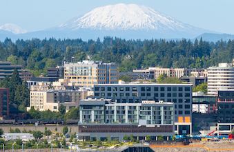
Vancouver, United States
Vancouver is a city located in Washington state, just north of the Columbia River and across the river from Portland, Oregon. Although many people confuse it with the f [read more.]
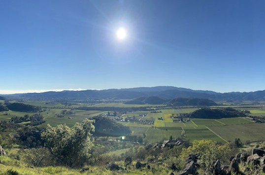
Napa Valley, California. United States
Napa Valley is one of the world's most prestigious wine regions, located in Northern California, approximately 80 kilometers from San Francisco. Its modern history be [read more.]
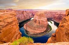
Grand Canyon, United States
The Grand Canyon is one of the most iconic natural landmarks in the world, located in northern Arizona and carved over millions of years by the Colorado River. Stretchi [read more.]
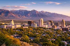
Salt Lake City, United States
Salt Lake City is the capital of the state of Utah and the cultural and economic center of the region known as the Wasatch Front. Founded in 1847 by Mormon pioneers led [read more.]
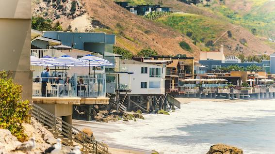
Malibu, United States
Malibu is a coastal city located in the state of California, about 30 miles west of downtown Los Angeles. Known for its scenic beaches, Pacific Ocean cliffs, and celebr [read more.]
To see more Waypoints in North America, please become a member here.
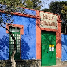
The Frida Kahlo Museum
The Frida Kahlo Museum, known worldwide as the Blue House, is located in the heart of Coyoacán, one of Mexico City’s oldest and most culturally rich neighborhoods. B [read more.]
Dominica, Caribbean
Dominica is an island country located in the Lesser Antilles of the Caribbean, situated between the French islands of Guadeloupe (to the north) and Martinique (to the south). Its capital and [read more.]
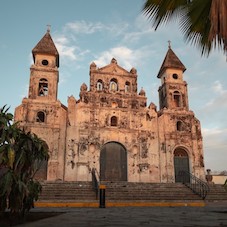
Granada, Nicaragua
Granada, also known as the "Great Sultana," is one of Nicaragua's most prominent colonial cities, renowned for its abundance of churches and religious facades. Founded in the 16th century, [read more.]
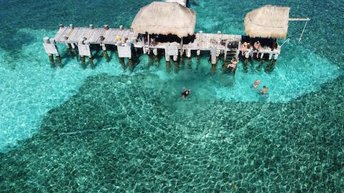
Isla Mujeres, México
Off the coast of Cancún, just 19.7 kilometers across the Caribbean Sea, lies Isla Mujeres, “a small paradise where Mayan history, island tranquility, and sustainable tourism converge” ( [read more.]
Holbox Island, Mexico
Holbox Island, whose name means "black hole" in Mayan and is pronounced "hol-bosh," is a peaceful island located in the Yucatán Channel, north of the peninsula, in the state of Quintana Roo [read more.]
Barra del Colorado, Costa Rica
Barra del Colorado is a remote enclave located on the northeastern tip of Costa Rica's Caribbean coast, in the province of Limón, bordering Nicaragua. It has been protected as a National [read more.]
Zihuatanejo, Mexico
Zihuatanejo is a former fishing village located in the bay of the same name, surrounded by the Sierra Madre del Sur mountains. It developed alongside Ixtapa since the 1970s, but retaining it [read more.]
To see more Waypoints in Central America, please become a member here.
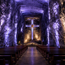
The Salt Cathedral of Zipaquirá, Colombia
The Salt Cathedral of Zipaquirá is an underground temple carved into a former salt mine, located in the Salt Park on the outskirts of Zipaquirá (Cundinamarca). Its modern architecture comb [read more.]
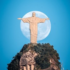
Christ the Redeemer, Rio de Janeiro
Christ the Redeemer stands atop Corcovado Mountain, within Tijuca National Park, dominating the Rio de Janeiro skyline with an imposing and serene presence. This monumental statue, 30 meters [read more.]
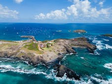
Fernando de Noronha, Brazil
Fernando de Noronha is a small volcanic archipelago in the South Atlantic. It is famous for its golden sand beaches, crystal-clear waters, and abundant marine life; much of the territory (ap [read more.]
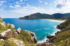
Florianópolis, Brazil
Florianópolis, affectionately known as Floripa, is the capital of the state of Santa Catarina, located partly on Santa Catarina Island and partly on the mainland in southern Bra
[read more.]
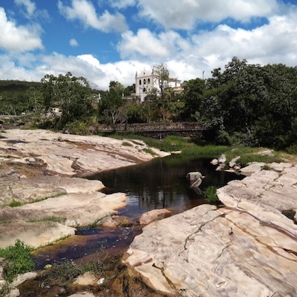
Chapada Diamantina, Brazil
Chapada Diamantina National Park, created in 1985 and managed by ICMBio, protects over 152,000 hectares of the Serra do Sincorá mountain range in the state of Bahia. Its territory encompass [read more.]
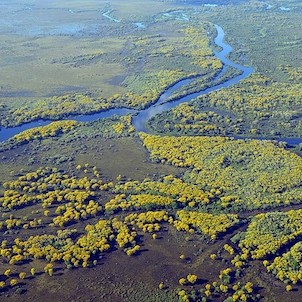
The Great Pantanal, Brazil
The Gran Pantanal is the world’s largest expanse of tropical wetlands, a vast territory of floodplains that extends primarily across the Brazilian states of Mato Grosso do Sul and Mato Gro [read more.]
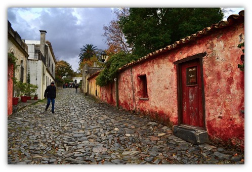
Sacramento Colony, Uruguay.
Colonia del Sacramento, on Uruguay's western coast opposite Buenos Aires, is a magnet for those seeking photogenic charm, cobblestone streets, and a leisurely pace. Founded by the Portugue [read more.]
To see more Waypoints in South America, please become a member here.
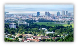
Port of Spain, Trinidad and Tobago
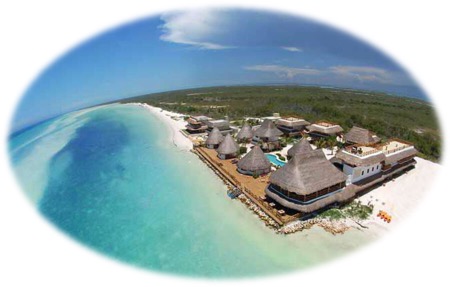
Puerto Rico
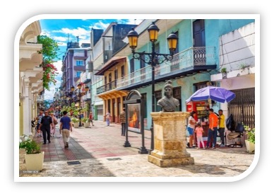
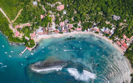
The Colonial Capital of Santo Domingo
El Yunque, Puerto Rico
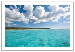
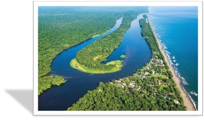
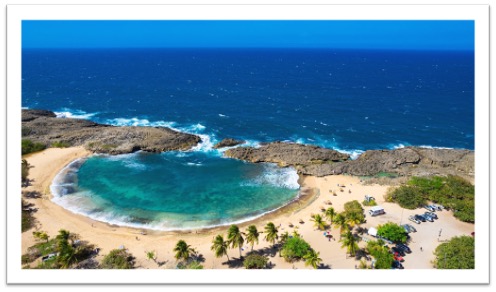
Eagles Bay, Dominican Republic
To see more Waypoints in The Caribbean, please become a member here.

|
Waypoint Finder (Over 1,000 destinations in PanAmerica) |
|---|